 Official Louisiana State Websites use .la.gov
  Secure .gov websites use HTTPS
 Aerial Waterfowl Surveys
Louisiana’s 3.5 million acres of coastal marshes, key habitat for waterfowl, are declining in both quantity (approximate loss of 25,000 acres a year) and quality (conversion to more saline marshes). This may be changing waterfowl distribution within the coastal zone. Extensive land use changes have also altered inland waterfowl wintering areas. It is important to document the relative population of ducks and geese and their habitat use by region to monitor status, measure changes, and assess the effectiveness of current management activities.
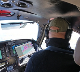
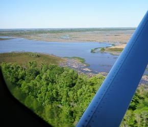
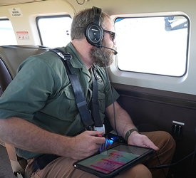
LDWF conducts an aerial survey from September through January to monitor populations and distributions of waterfowl. Staff fly in a fixed wing aircraft at an altitude of 125 feet at approximately 100 mph along 27 north-south transect lines from the Gulf northward to U.S. Highway 90. The transects are a quarter mile in width and vary in length from 8 to 48 miles. Survey lines are spaced at 7.5 mile intervals in the southwest and at 15 miles in the southeast resulting in 3% and 1.5% sampling rates in the two areas, respectively. Staff record the number and species of waterfowl by habitat type on each survey line then statistically expand these counts to estimate the number and species of waterfowl that use the marshes and adjacent agricultural habitat in coastal Louisiana. In addition, aerial surveys are flown at Catahoula Lake and selected habitats in northeast and northwest Louisiana. These cruise surveys are not based on transects but attempt to count all waterfowl encountered in those areas. Staff also conduct an aerial survey using transects on Lakes Maurepas, Pontchartrain, and Borgne in December and January to estimate the number of scaup using this continentally important winter habitat. During aerial surveys, staff also record information on current waterfowl habitat conditions, weather patterns, and migrations. They compile survey results and submit reports to cooperating agencies and interested individuals.
Transect surveys estimate the total number of birds using the entire surveyed area through random sampling and statistical expansion. Cruise surveys attempt to count all birds on a particular area but are not representative of an entire region.
Aerial Waterfowl Survey Gallery
LDWF also participates in the coordinated Mississippi Flyway goose count in as part of the U.S. Fish and Wildlife Service mid-winter waterfowl survey in early January. Data from this survey help to identify changes in abundance and distribution of geese and have been used to evaluate changes in waterfowl hunter success. Reports from this survey are most helpful when discussing waterfowl issues with concerned citizens, outdoor writers, and wetland specialists from around the country.