 Official Louisiana State Websites use .la.gov
  Secure .gov websites use HTTPS
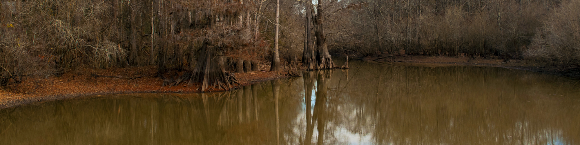
Russell Sage WMA
Russell Sage WMA forms one of the largest remaining tracts of the vast bottomland hardwood forests that historically composed the lower Mississippi River floodplain from lower Illinois to the Gulf of America. Russell Sage WMA was the very first LDWF-owned WMA. LDWF purchased 15,000 acres of the property in 1960; since then, LDWF has leased and purchased several adjacent tracts. LDWF also consolidated the former Ouachita WMA with Russell Sage WMA in March 2015. In total, LDWF owns 34,010 acres of the property, the U.S. Army Corps of Engineers owns 2,955 acres, and the Ouachita Parish School Board owns 1,240 acres.
For more information,
contact Mitch McGee at
mmcgee@wlf.la.gov or
318-343-4044.
Located within the Bayou LaFourche floodplain, Russell Sage WMA is flat, poorly drained, and subject to annual winter and spring flooding. Elevations range from 55 to 63 feet above sea level. Numerous sloughs and shallow bayous meander throughout the property, and there is annual backwater flooding. Abandoned and active mineral exploration and production sites, roadways, pipelines, open water lakes, sloughs, and bayous provide diversity throughout the area.
LDWF has planted approximately 4,000 acres of hardwood seedlings to restore the old Ouachita WMA portion of the area to its condition before it was cleared for farming in the 1960s. The forest canopy contains a mixture of bottomland hardwoods grouped into two major timber types: oak-elm-ash and overcup oak-bitter pecan (water hickory). There are smaller areas of cypress-tupelo, gum, and black willow. Individual tree species include honey locust, cedar and winged elm, sweetgum, sugarberry, green ash, red maple, cottonwood, nutmeg and bitternut hickory, and nuttall, willow, and delta post oak. Common woody understory species include peppervine, deciduous holly, poison ivy, rattan, swamp privet, buttonbush, climbing dogbane, palmetto, greenbrier, dewberry, roughleaf dogwood, trumpet creeper, persimmon, box elder, grape, and hawthorn.
LDWF has developed 13 waterfowl management units totaling 7,770 acres on this WMA. This includes 2,500 acres of flooded agricultural fields, 4,500 acres of moist soil management units, 2,550 acres of greentree impoundments, and 220 acres of shallow water areas.
WMA Details
Acreage
38,208 acres
Parishes
Morehouse, Ouachita, Richland, and Caldwell parishes
Owner/Manager
LDWF, U.S. Army Corps of Engineers, Ouachita Parish School Board.
Activities and Amenities
Hunting and Trapping
The most popular game species on Russell Sage WMA are white-tailed deer, waterfowl, squirrel, and rabbit. There is a small game emphasis area on this WMA. The areas managed for waterfowl, along with the numerous sloughs and waterways, offer excellent waterfowl hunting. There are youth deer and squirrel seasons. Hunting is also available for dove, raccoon, snipe, and woodcock. There is a dove field, planted annually in brown-top millet, available to area users. See LDWF's seasons and regulations for details.
In addition, there is a physically challenged wheelchair-confined hunting area, deer season, and waterfowl lottery hunt.
Fishing and Boating
Recreational fishing for freshwater species including largemouth bass, crappie, sunfish, and catfish, crawfishing, and frogging are popular with area users. Commercial fishing is also available. See LDWF's seasons and regulations for details.
Camping
There are two primitive camping areas on Russell Sage WMA.
Birding and Wildlife Viewing
Many neotropical birds and shorebirds visit Russell Sage WMA annually. The area is also home to large numbers of passerine and wading birds. The areas managed for waterfowl, wading birds, and shorebirds, along with the numerous sloughs and waterways, offer excellent birding. There is a wildlife viewing tower overlooking several waterfowl impoundments in the waterfowl refuge. Russell Sage WMA is also a great location for viewing terrestrial birds and raptors.
Louisiana black bear frequent this area; reported sightings have been increasing.
Hiking
Several walking trails follow pipeline rights-of-way.
Other
Horseback riding, berry picking.
Louisiana black bear frequent this area; reported sightings have been increasing.
Address
North: 3034 Highway 80 East Monroe, LA 71201
South: 120 Bud South Road Monroe, LA 71202
Directions
Russell Sage WMA is located about 7 miles east of Monroe and 10 miles west of Rayville. You can access the WMA via U.S. Highway 80 and 165, Louisiana Highway 15, and I-20. LDWF maintains a system of all-weather gravel roads and numerous ATV trails on the WMA. There are 12 self-clearing permit stations located at major entrances to the WMA.